
Walk Kingsville Streets by Address
A street-by-street search starts by standardizing the number and street name, not by treating one result as a roster. USPS can normalize delivery form, while the Kleberg County Appraisal District, or CAD, connects a simple street number and name to an assessed parcel. Save the property ID, geographic ID, subdivision, and legal description when they appear. Those details hold the trail together when a corner parcel uses another street, a unit does not search cleanly, or the address lies near the city limits.
- Run the exact address through USPS ZIP Lookup, then use CAD with only the street number and simple street name.
- Record the CAD property or geographic ID, subdivision, and legal description. Treat the owner shown there as an assessment lead.
- Open the CAD-linked interactive map to orient the parcel and its nearby parcel IDs. The public map is a companion to the property search, not proof of title.
- Use the current County Clerk records search for modern instruments, then carry the legal description and party names into the historic index as needed.
- For a dated household clue, read the street sequence in a verified directory year and compare it with newspaper or archive material.
Note: A voter record, a deed party, and a CAD owner each describe a dated record relationship, not a guaranteed current occupant.
Kingsville Street Directory Evidence
Several address-keyed sources can be used together, but their meanings should not be blended. CAD identifies an appraisal account and the parcel it uses. A deed identifies recorded parties and a legal interest. A city permit can date work on a structure. A printed directory gives a publication-time listing. The following Kingsville street directory evidence is most useful when each row is dated and kept in its own column of a research log.
| Address record | Local keeper | What it can show | Access path |
|---|---|---|---|
| CAD parcel record | Kleberg County Appraisal District | Assessed owner, situs, property/geographic ID, subdivision and legal-description lead | Online property search; CAD office |
| Parcel geography | CAD interactive map | Parcel orientation and nearby parcel IDs where publicly displayed | CAD-linked map; live field detail was not captured |
| Recorded land instrument | Kleberg County Clerk | Grantor, grantee, recording path and legal description | Current portal, Kofile index, counter, phone, mail |
| Permit or code file | Kingsville Planning and Development Services | Address-based construction, inspection, or code-event lead | Specific Texas Public Information Act request |
| Printed street listing | Library, TSLAC, and newspaper archive | Dated name, household, phone, or address listing when printed | Reading room, library shelf, or digitized newspaper |
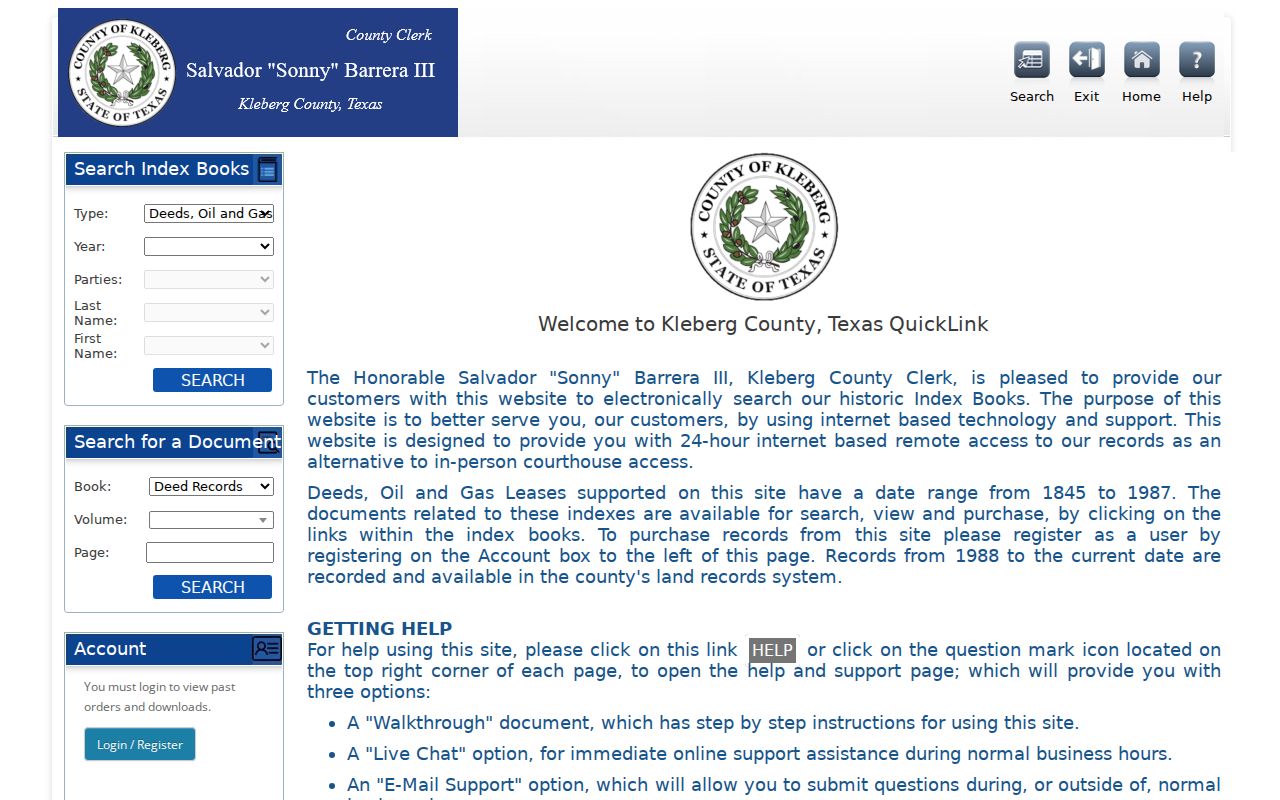
The County Clerk’s two online land-record channels split at September 1987. The current Kleberg public records search covers real-property records from September 1987 forward, while the historic route handles older deed and oil-and-gas index work. The clerk counter and public terminal remain useful when a portal does not expose the image, a plat, or a needed older record.
Search Kingsville CAD by Street
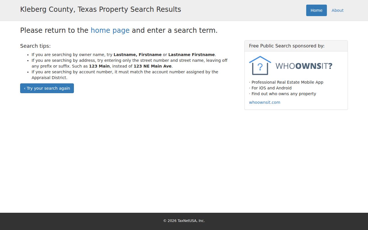
Kleberg CAD is the practical first stop for a current Kingsville street search. Its public form has By Owner, ARB Search, and Advanced branches. Use a plain street name because the official help says not to include a prefix, suffix, or unit number in that field. If a basic search is broad, add a subdivision, condo, mobile-home park, owner name, or geographic ID. The CAD page identifies its values as appraisal information, so the legal description and acreage still need independent verification.
| CAD field | How it helps an address search |
|---|---|
| Street Number | Enter the number only, then test variations separately if needed. |
| Street Name | Use the simple name without prefix, suffix, or unit numbers. |
| Owner Name | After a parcel lead, try Last Name First Name or Lastname, Firstname. |
| Property ID / Geographic ID | Use an exact identifier to return to the same assessed parcel. |
| Subdivision / Condo / MobileHomePark | Useful when a unit is represented through a named complex or park. |
| Neighborhood / Tax Year | CAD filters that can narrow the property context; rendered option lists may change. |
A parcel is the land unit used in the appraisal system. A situs address is the physical location used for the parcel, permit, or delivery context. A plat maps a subdivision’s lots, blocks, rights-of-way, or parcel layout. A criss-cross directory lists an address sequence so a researcher can read a street rather than begin with a surname.
CAD’s public-search help is shown in the captured Kingsville street directory image below. The syntax reminder matters because a failed formatted-address search can look like a missing parcel.
Use the result as a search aid, then preserve the returned identifiers before moving to the deed index or map.
Kingsville Deeds Along a Street
Deed work is keyed more reliably by party and legal description than by the modern street number. The County Clerk identifies the historic Kofile index as covering deeds and oil-and-gas leases from 1845 through 1987. It offers Type, Year, Parties, Last Name, and First Name controls, plus a separate Book, Volume, and Page document mode. The newer county system starts in September 1987. Search the buyer as a grantee for the purchase, then treat the prior grantor as the next name going backward.
A recorded grantee mailing address can be outside Kingsville and is not automatically the property address. The County Clerk’s recording rules require a legal property description and, for deeds after December 31, 1981, the mailing address of every grantee. Record the situs, legal description, and mailing address in separate fields. When a plat is needed, electronic plats are available on request from the clerk, and the counter can clarify whether a local image or plat is available.
The historic Kleberg deed index is the source shown here. Its index search is distinct from viewing or purchasing a document image, so an index hit should be treated as a pointer to the record rather than the record itself.
The 1987 boundary is a useful checkpoint: carry the parties and legal description across it instead of assuming one portal contains the whole chain.
Kingsville Permit and Code Files
Planning and Development Services can add a construction or inspection date to a Kingsville address trail. The city says permits cover remodels, repairs, replacements, additions, and new structures. Current residential review is listed as 10 business days and commercial review as 20 business days, which describes current processing, not historical file coverage. No online address-case search was located for older permits or code matters.
Ask the city for a record by exact address, date range, and record type through its open-record request process. Planning Administration is listed at 361-595-8055, Permit Administration at 361-595-8019, and Code Compliance at 361-595-8093. A request can distinguish a permit attachment from a code file and can ask for inspection before copying. City records may be subject to redaction, and a permit event does not establish who lived there.
Kingsville Planning’s maps and plans page appears in this street directory image. It is a useful location layer for a record request, especially near the ETJ or a historic district.

Pair a permit date with a deed, a directory, or a map before drawing conclusions about a particular household.
Kingsville Historic Street Forms
Old address research needs the printed street form kept intact. The city’s historical design guidance identifies Richard, Henrietta, Alice, and Lee as street names tied to the King family and friends. It also describes a historic business area along the 200 through 400 blocks of East Richard and the surrounding Hispanic-community context. Those details help place a historical listing, but they do not convert an old listing into a present-day household record.
No official citywide renumbering year or before-and-after crosswalk was found. For a disputed address, compare the original directory or newspaper form with a Sanborn sheet, planning map, and County Clerk legal description. Kingsville has verified Sanborn map eras for 1915 and 1962. The map can test a building footprint or street geometry, while the deed and directory provide separate title and listing evidence.
Kingsville Street Directory Years
For a past street sequence, the verified Texas State Library and Archives Commission holdings are Kingsville directories for 1954–55, 1974, and 1984. A 1963 Polk’s Kingsville directory is a catalog lead that needs item verification. The Robert J. Kleberg Public Library states that it currently subscribes to the Kingsville City Directory and shelves back issues with the Texas Reference Collection. Ask the library about reverse directories, microfilm, vertical files, and any unlisted local material.
Read the listing as a dated snapshot. Names, street address, telephone, spouse or household notation, and sometimes a business line can be printed, but no directory guarantees the same fields or complete coverage. The Kingsville city directories collection is the fuller route for the historical shelf. Along a street, compare the same printed form in the next verified year before assuming a move or a vacancy.
Note: A name absent from a printed street sequence does not prove that the address was unoccupied.
Kingsville Street Boundary Checks
A Kingsville postal city line, a city-limit line, and a county parcel boundary can point to different custodians. The city’s planning maps include a city limits–ETJ map and current streets map. The Census Kingsville boundary map provides another municipal reference. Neither replaces USPS delivery normalization or the CAD parcel record.
When an address is in the ETJ or unincorporated Kleberg County, ask which office holds the permit, code, tax, or land record rather than assuming city custody. The county directory lists an addressing coordinator at 361-595-8593. City Planning can also clarify city, ETJ, or subdivision context. This check is especially useful when 78363 or 78364 appears in the mailing line.
Kingsville CAD Search Tip
Start broad, then refine. The CAD Street Name field is designed for the simple name, without a prefix, suffix, or unit number. After a broad result, use subdivision or geographic ID rather than packing every address detail into the first query. Original Townsite, Santa Gertrudis Estates, Forrest Park, and Luera are examples of local legal-description context identified in county notices.
This small input rule avoids a common false negative in a Kingsville street directory search. It also keeps a unit or building label separate from the appraisal parcel when a complex or park has its own search field.
Kleberg CAD also identifies its 2026 values as current assessment context and posted real-property notices on April 1, 2026. The listed protest deadline was May 15 or 30 days after notice under Tax Code Section 41.44(a)(1). Keep the tax year beside a Kingsville street result. A current appraisal entry cannot answer a historical-address question without directory, deed, or map evidence from the relevant period.
Limits of Kingsville Street Searches
Street evidence must stay proportionate to what it records. CAD and GIS establish current appraisal or map context. A deed establishes a recorded interest. A directory or newspaper lists a person or household at a date. The VoteTexas lookup uses name, county, date of birth, and ZIP, and it is not a street-wide roster. Protected voter addresses can be suppressed, and the county registrar should be contacted for lawful public-record procedures rather than for confidential data.
Lawful use. Kingsville address records are for personal, lawful research and careful historical work. Never use an address trail to stalk, harass, intimidate, or harm anyone.
Keep conflicting printed forms instead of forcing a match. County Clerk counter and public-terminal access, phone, mail, a focused Chapter 552 request, library materials, and archives are all documented fallbacks when an online street search ends without a reliable answer.